
The Cape to Cape Track is a fantastic way to explore our spectacular coastline!
The Cape to Cape Track is a 123km trail that runs from Cape to Cape through the Leeuwin-Naturaliste National Park following the coast over the ridge and along the beaches, with Cape Naturaliste lighthouse at the northern end and Cape Leeuwin lighthouse at the southern end of the track.

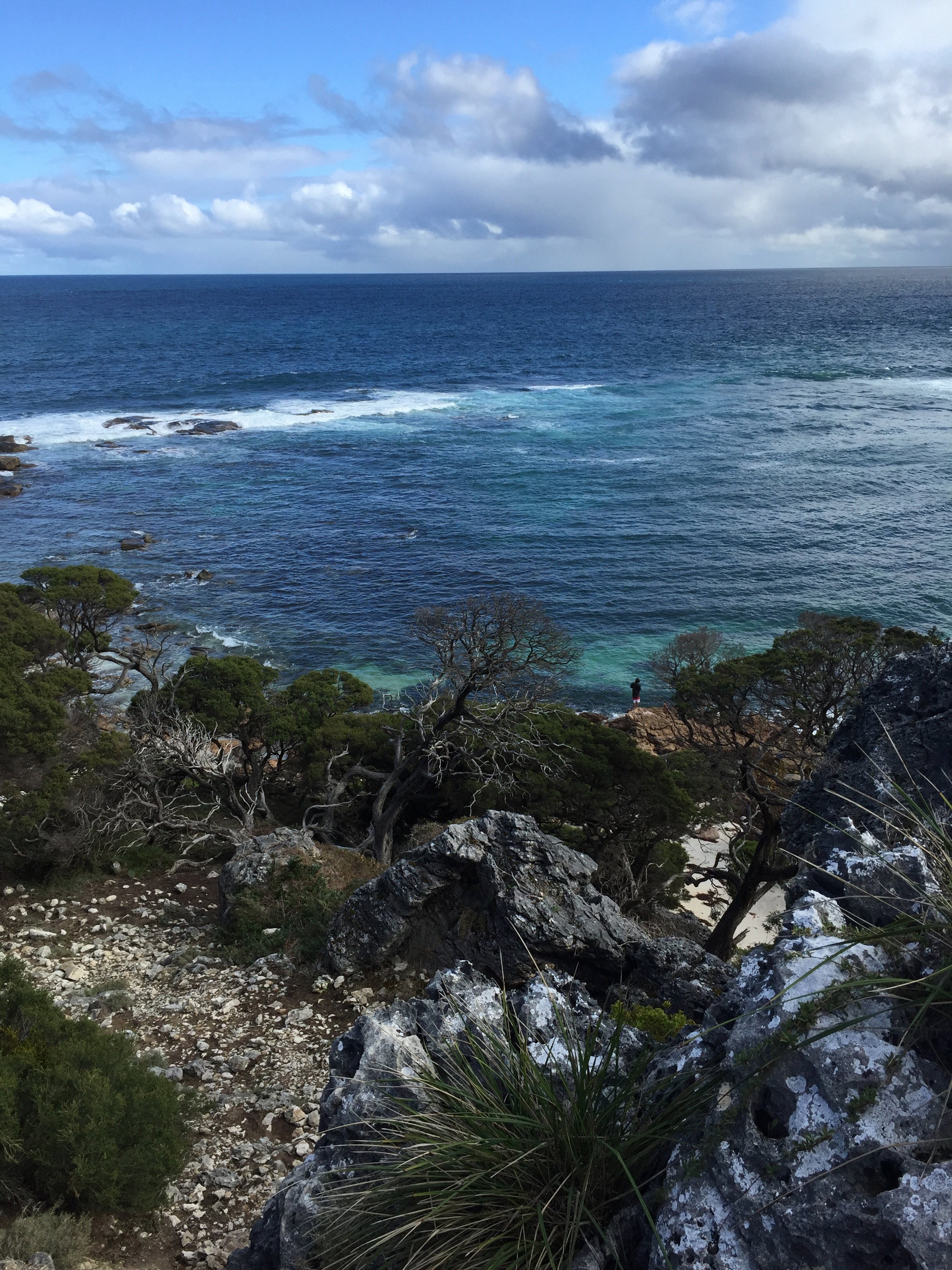
Yallingup to Canal Rocks, on the Cape to Cape Track
The track is designed to bring you in close contact with the environment, and it certainly achieves this. The track is made up of different types of terrain and surface from sections of old 4wd tracks, boardwalk, steep steps, narrow rocky sections and soft sandy beaches. The track mainly follows the coast, with many sections offering mind-blowing cliff top views of the Indian Ocean and sweeping sandy beaches. The track also meanders inland through lush, sheltered woodland enclaves and spectacular Karri forest. The Cape to Cape track takes you through the popular beachside towns of Yallingup, Gracetown and Prevelly. It’s a magic way to see the diverse environment that the south west of Western Australia has to offer. With the everchanging display of vegetation, ocean vistas and wildflowers, no section of the famous Cape to Cape track is the same.
How long do I need?
The track can be tackled all at once, taking 5-7 days with camping along the way, which is a great challenge for hiking enthusiasts or broken up into smaller half-day or full-day walks. With multiple access points along the coast people can now choose to complete the track in sections.
Add it to your list of Things to Do
If you are a lover of the outdoors then we suggest making it your mission to complete a small section of the track while on holidays down south, so add a bushwalk to your list of things to do on your next trip. It will be a great achievement, you’ll see some memorable scenery and it will make lunch at one of the local Margaret River Region wineries even more rewarding!
Is it an easy walk?
Trails WA rate the Cape to Cape Track a Grade 4 trail, with Bushwalking experience recommended. Tracks may be long, rough and very steep. Directional signage may be limited. The track goes from easy to difficult depending on the section of trail. So do your research & prepare properly before you set off.

Wildflowers in October on the Cape to Cape Track.
When should I go?
The Cape to Cape Track is a walk for all seasons, as long as the appropriate preparations are made, though Spring and Autumn would have to be our favourite times to hit the track. September to November are lovely and you will be treated to magnificent wildflower displays and enjoy the whales migrating along the coast, possibly with their calves, as they head back down south.
Bobs Hollow on the Cape to Cape Track, between Redgate and Contos.
Our Pick of the track
Our Pick: Every section of the track offers something so different it is hard to pick a favourite, however if you are looking for a nice walk with the perfect mix of famous Cape to Cape scenery, including a section of beach and stunning clifftop views with easy access from Margaret River town then we can’t go passed the section from Redgate to Contos.
Park your car at Redgate Beach carpark and start your walk from the carpark down along the length of Redgate beach, at the southern end of the beach you will find a small track, start to meander your way up the narrow bush track finding a Cape to Cape sign. Leaving the beach you follow 4wd vehicle tracks until you reach Bobs Hollow, on this walk you will come passed some limestone caves and as you approach Contos you will find yourself walking along the top of the Contos cliffs – look out for dolphins, whales and salmon schools, depending on the season. Along this section it is common to wake a resting kangaroo, surprising you both! At the end of the cliffs, as the track starts to bend to the east away from the coast and before you reach Contos Road, you’ll find yourself at the point to turn around and return to Redgate beach where your car is parked.
This is an approx. 12km return walk, you can make it a 6km one way walk by arranging a lift back from Contos Road. Note: please use this info as a guide only, study a map and be prepared before you leave!

View from the top of the Contos Cliffs, along the Cape to Cape track.
Walking in Circles
Another great option is to complete a loop walk from the “Walking round in Circles” book by Jane Scott. It features 29 circuit walks with many featuring a section of the Cape to Cape track so you can return to where your car is parked. You can purchase this book from the Visitors Centre, the Margaret River Bookshop and the Prevelly Caravan Park General Store.
Cape to Cape maps and resources
There is a fantastic Cape to Cape Track Guidebook by Jane Scott & Ray Forma which is in its 8th edition and offers a great guide that is designed to fit in your backpack and makes a great souvenir of your walk. This guidebook can be purchased from The Margaret River Visitors Centre.
Online you can access the Friends of the Cape to Cape website which has lots of helpful information for planning your walk including maps and Track Facts!
Get out and start exploring
We love the Cape to Cape Track as it is one of the best ways to get out and about in the Margaret River Region and really experience the natural beauty of the area with its rugged coastline, postcard perfect beaches, limestone caves, wildlife and beautiful forests.
So pop on your hiking shoes, pack your water bottle & a camera and get hiking!!

Willyabrup Cliffs, on the Cape to Cape Track


